Bailey Lane Click here to go back to A-Z page |
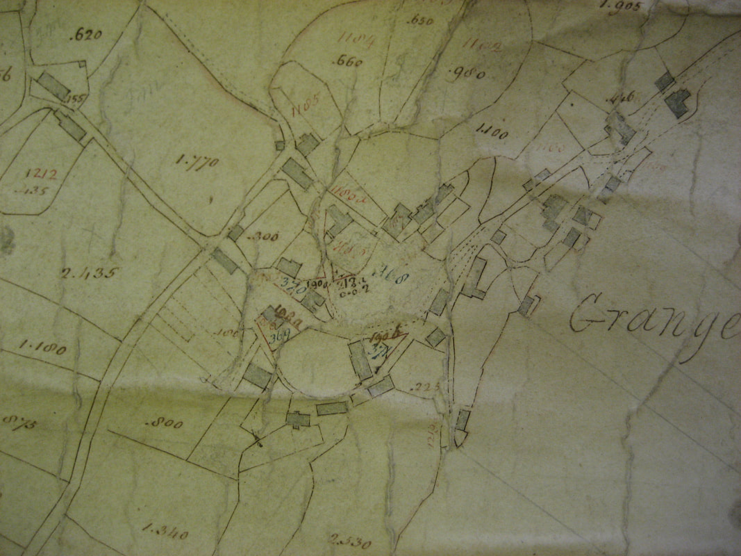
Until the coming of the railway, the shore was accessible at various points – notably at Windy Harbour (roughly where the roundabout is near the station) where the road ran along the sands, by the Commodore (Commercial Inn as it was then), Bailey Lane and Clare House Lane. The map below from 1796 shows Bailey Lane reaching the shore beside a building.
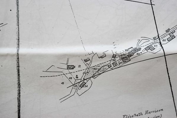
When the railway was constructed, the map accompanying the parliamentary act (Ulverstone & Lancaster Railway Act 1851) showed the layout as it was immediately prior to the railway. I'm not sure whether the building number 54 was/is crossing cottage or not. Possibly not, as the current cottage looks like a purpose built railway style dwelling, and too parallel to the railway to be such by chance.
In The Act itself, clause XIX set out a number of level crossings that had to be made including: "a certain highway, numbered 54a, in the township of Broughton East, in the parish of Cartmel...where the line crosses the same'. Clause XX set out the requirement to build a lodge at each crossing.
|
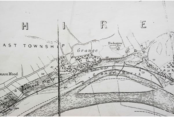
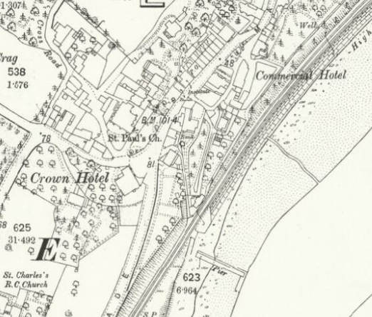
The access to the shore from the centre of Main Street was blocked by the new railway, so a path was constructed so that people could get to Bailey Lane crossing from the shops and facilities – as shown on the Ordnance Survey map of the era. This was whilst the area below the pub and houses was a garden of some nature. It's now the car park below the Commodore, but the line of the old path veered slightly to the west, then turned left and went up to the roads. The only section of enclosed path remaining is from the Car Park to Bailey Lane. |
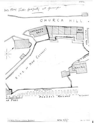
Morecambe Bank was built sometime after 1902, as planning documents in Barrow Record Office show. This shows the public footpath from crossing cottage to the car park.
|
In 1876 the Grange Visitor reported an 'Important Meeting of the Ratepayers' - which described a 'public road down to the shore down from the Crown Hotel, by a level crossing'. The meeting was all about how to get rid of this objectionable crossing as it was most unsafe - 'anyone with a family of children would not wish to cross that without some protection'. |
Your browser does not support viewing this document. Click here to download the document.
|
|
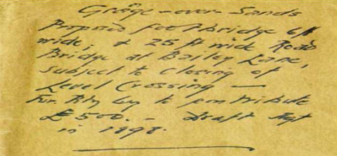
In 1898, a proposal was in development between the Furness Railway Company and Grange-over-Sands Urban District Council. This proposal was to replace the Crossing with a 25ft wide vehicular bridge and 6ft wide footbridge (see extract left). However, the proposed replacement of the Crossing was never delivered. |
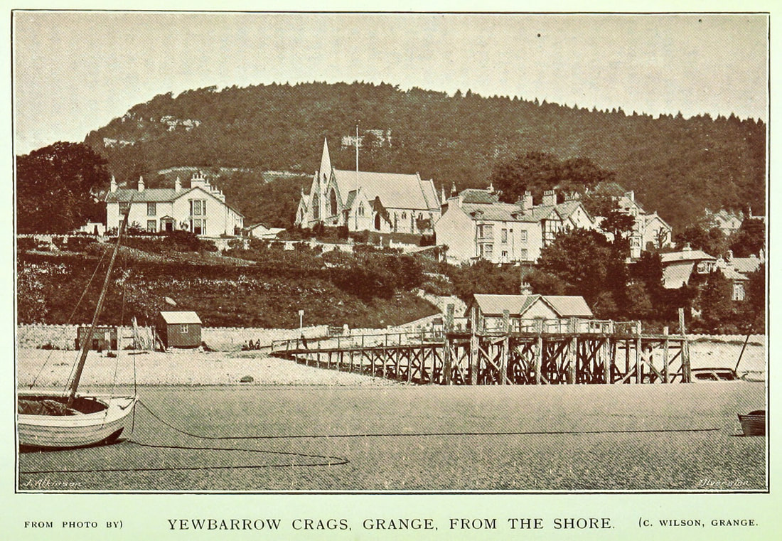
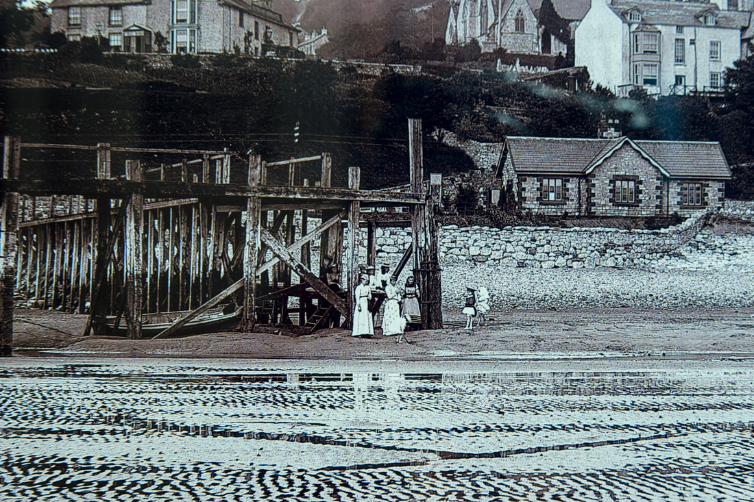
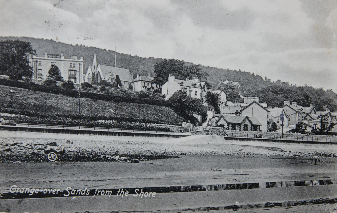
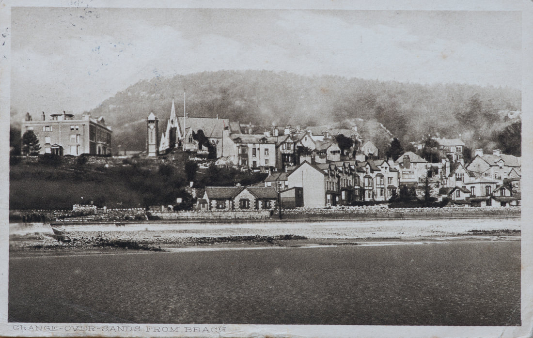
In 1875 the Morecambe Steam Boat Company built a pier at the foot of Bailey Lane for its steamers to call at bringing day-trippers to Grange from Morecambe and elsewhere. They all used the crossing and Bailey Lane, or the path to Main Street to access the town. In the two pictures below (c1894), you can see the gates and the ramp down to the shore before the promenade was built (if you have a look in the railway wall to the left of the crossing, you can still see some fittings).
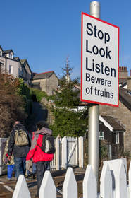
The gates were still there in 1914, as the postcards from 1912 and 1914 after the prom was built (1904) shows - if you look carefully (right click and choose 'open image in new tab' to enlarge) - you can see the 'stop, look, listen' type signs as well.
A second pier was built at Clare House Lane, and the Bailey Lane Pier gradually fell into disuse and disrepair – disappearing some time in the early twentieth century.
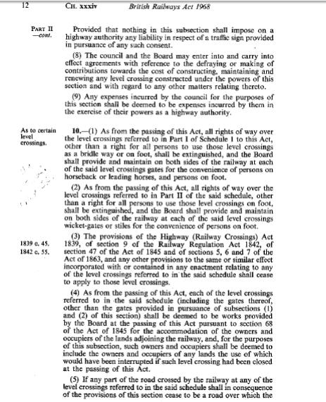
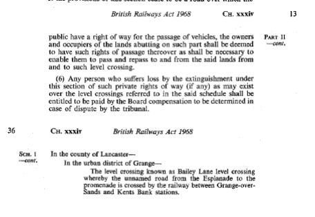
Bailey Lane crossing remained an all purpose level crossing until the British Railways Act 1968 - the bottom two cuttings show that it was stopped up under this Act, retaining a right for all persons to use the level crossing on foot (ie: a public footpath). The whole length of the route from Crown Hill to the shore is Bailey Lane.
What's
|
Bailey or Bayley?
No-one knows, and it has different spellings depending on where you look. I’m not sure what it means either. Bailey generally relates to castles or land managers (bailiff) – none of which really apply here. It could possibly be connected to a ‘warrant officer’ if customs were applied (although the customs officer lived at Windy Harbour). Another possibility could be field of bay trees (if using the Bayley spelling). A further suggestion is ‘berry clearing’ or ‘berry wood’ and this is particularly used in Lancashire, but there is little to show that all this was wooded. Finally, it could simply be the lane leading to property owned by the de Baylegh family (from Lancashire – but I don’t know if they had any connection with Grange). |
The level crossing has been closed by Network Rail since July 2017 because of safety concerns. Here's what a blogger had to say about the magic and energy of the crossing suningemini.blog/2022/02/13/cross-crossing/
A local Public Inquiry was held in 2021/2022 into the closure of the crossing; the Secretary of State declined to confirm the order, and concluded that Network Rail could/should do various improvements to make it safer. These are awaited (September 2022).
